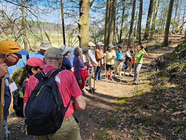
This sign appeared a year or so ago on Quarry Road in Great Barrington. I had been up the trail to East Rock about 10 years ago. It was steep, slippery and seemed dangerous. In fact an aquaintance of mine broke his leg up there about that time.
The trail has changed! It is wide and, although still steep, it is hard dirt with few obstructions. It takes about 30-40 minutes of climbing to reach East Rock which has a ladder to help you up to the view. The trail continues past the boulder a short distance to the top of the ridge and then seems to disappear.
I recieved some information by email from Great Barrington Assistant Town Manager, Christopher Rembold, about it. He said, "The trail originates on town land off Quarry Street, but eventually crosses into private territory. The peak, and the Rock itself, are on private land. The Town does not maintain any of the trails." It is obvious that some interested party(ies) are keeping up the trail and I thank them for that. Please be sure to respect private property.
The hillside has other trails that, judging by their twisting nature, were made for mountain biking but I enjoyed walking some of them. You can see rugged rock bolders and cliffs, a couple of vernal pools, some large older trees, and three-season views from the ridgetop trail.
I learned from articles in the Berkshire Eagle by Bernard Drew, our local historian, that the town's 70-acre property has some interesting history. It was donated to the town in 1894 by Edward F. Searles, then owner of what is now called Searles Castle behind the rock wall on Main Street just south of downtown. The corner of Quarry and Park Streets has a small playground and field. In my opinion, the whole hillside is a treasure!
 |
The trail has lots of interesting rock formations to look at.
|
 |
I love to see this ice formation, mostly in fall and spring.
It is needle ice. See below for an explanation of how it forms.
|
 |
I saw several vernal pools
filled with water from a recent day of rain. |
 |
In the first half of the 1900s, a high tension electric line went over the mountain
to supply power to a trolley line. This must have been where
a guy wire to support a tower was fastened into the rock. |
 |
| The trail is wide and clear of debris. |
 |
East Rock: The ladder is not affixed, but does allow the adventurous
to access the view. It's not for the faint of heart!
|
 |
I can only guess when the EAST was carved into the rock.
From other lettering I have seen, probably in the late 1800s.
|
 |
The trees just below East Rock have been felled to open up the view.
On a clear day Main Street the Catskills are visible.
|
 |
At the top, someone has a stash
of loveley pebbles and shells. |
Needle Ice formation: Soil takes longer to cool than the air does, so in the earlier parts of winter the air may be well below freezing, while the ground is still thawed and water flows freely through it. If the air is sufficiently cold, water at or near the soil surface may freeze. Water expands when it freezes and this ice expands into the empty space above. If the air is cold enough, it continues to freeze water near the surface. The expanding ice pushes ever upwards, drawing more water up through the soil by capillary action. The process continues, with endless tiny spires being thrust through the soil. Above the soil the spires may fuse together, forming small chunks 2-3″ thick.
Sadly, once the soil freezes completely, the process ceases. You're most likely to encounter needle ice in late fall before the soil freezes and again in early spring as it thaws. It’s also common in more mild winters (and in those odd spells where temperatures soar up to nearly 60). Essentially anytime the upper layers of soil have liquid water and when air temperatures are well below freezing you can find needle ice on a trail near you.